The offline roadbook for bikepacking, gravel & brevets
Know what's open at KM 437.
I built this for the Race around the Netherlands, because my spreadsheet wasn't good enough. Hand Rekker your GPX and it works out which shops, fuel stops and water taps are open by the time you get there. Then it sits on your phone and keeps working without signal.
Full offline data in ten countries. Anywhere else works online via OpenStreetMap.
03:47
KM 612 · Day 2 · Somewhere in the dark
21:58Last supermarket closed 4 hours ago
01:15Bottles: empty since the bridge
03:12Fuel station "just off route": open? distance? unknown
03:47Brain: no longer doing maths
The problem
On a big ride, nobody can tell you.
On a self-supported ride there's no crew and no car. Whatever you eat and drink, you find on the way.
And you tend to find out the hard way: the next supermarket closes in twenty minutes, the tap is 300 metres off route, everything in the next 60 km is shut until morning.
At hour 21, with a sleep-deprived brain, you shouldn't be doing logistics. Your roadbook should.
Why not just…
Your Garmin knows the way. Not what's on it.
Keep your bike computer for the turns. Rekker covers what you need along the way.
Bike computer
Google Maps
Rekker
Every shop, fuel stop and tap on your routeThe whole route at once, not one search at a time
Only what you add, a few hundred at most
One search at a time
Open or closed when you get thereBased on your pace, not the time right now
Only "open now"
Drinking water, including cemetery tapsWithin a distance of the route you choose
Some fountains, no cemeteries
Works without signalValleys, border crossings, the empty stretches
Maps yes, search and hours barely
Turn-by-turn directionsRekker isn't a navigator. Keep your Garmin for this.
YesPartlyNo
How it works
Plan at home. Glance on the road.
You need internet once, while you plan. On the road you don't need it at all.
At home · Online
01 / PLAN
Drop in your GPX. Get a plan.
Rekker splits your route into legs and finds every supermarket, fuel stop, bakery and water tap along it, with the opening hours for each country.
On the bike · Offline
02 / RIDE
One glance. Eyes back up.
Your current leg, with distance, climb and ETA on one screen. Places that will be closed when you get there are dimmed.
What's inside · free during the beta
What's in the roadbook.
The whole route as a roadbook
Every stop in riding order, leg by leg: how far ahead, how far off route, and whether it'll be open when you get there. The spreadsheet you'd build yourself, done in seconds.
Opening hours, baked in
Opening times for every day of the week, with local rules like Sunday closing in Germany. Tap any shop in your roadbook to see them. Where hours are estimated, Rekker says so.
Water within reach
Public taps and cemetery taps within a distance you choose, 300 m by default. Thinner in Germany, where fewer taps are mapped.
Wind and weather, per leg
Temperature and wind for each leg, at the time you'll ride it.
Elevation
An elevation profile of the whole route, and the metres of climbing to your next stop.
Checkpoints from your GPX
Controls and waypoints in your GPX show up as stops automatically. Add your own for sleep, food or a ferry.
Ethos
Built by a rider.
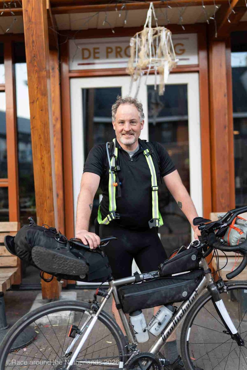
I'm Jesse. Rekker started as my preparation for the Race around the Netherlands: 1,900 km, self-supported. These days I ride brevets and ultras regularly, and Rekker comes along on every one. I'm also the one who reads your email when something is wrong. Next on the list: the Transcontinental in 2028.
At the finish of the Race around the Netherlands 2026. Photo: Race around the Netherlands
Offline is a promise
If a feature needs signal in the middle of a ride, it doesn't ship.
Open data
Built on OpenStreetMap and public water data. Every rider sees the same information.
Less screen, more road
Rekker is made to be checked and put away. No feed, nothing asking for your attention.
Roadmap
Where Rekker is headed.
Got an idea? Reply to any Rekker email. I read all of them.
Live now
Everything on this page, offline in ten countries.
Next
Better opening hours for fuel stations and bakeries. One shareable link per event. More countries along the Transcontinental route. Later a paid Pro version; water stays free.
On the horizon
North America. Hiking and pilgrimage routes. A small e-ink screen for your handlebar.
Early access
Get on the beta, free.
Free during the beta. Leave your email and I'll send you the link, plus an occasional note from a real ride.
Your route never leaves your phoneYour plan saves itself, also offline
✓ You're on the list. See you at the start line.
We only use your email to send the test link and, if you tick the box, occasional updates. Stored in the EU, never shared or sold. Unsubscribe or ask us to delete it anytime. Privacy